


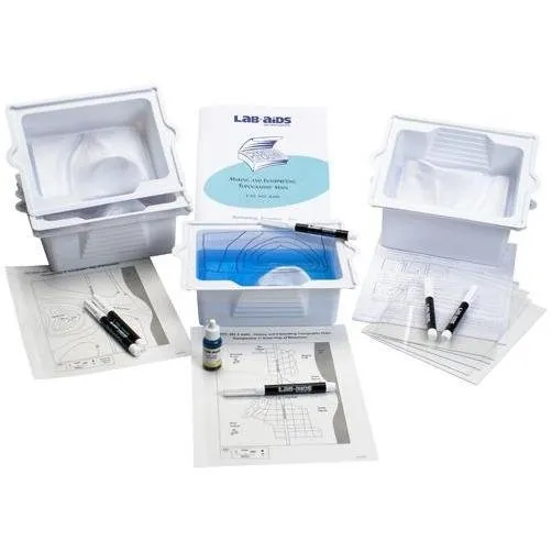
Lab-Aids: Making and Interpreting Topographic Maps Kit
This activity provides students with a basic understanding of topographic maps and how to interpret them. Students conduct a hands-on investigation using the LAB-AIDS‚® Topographic Model to construct contour lines and create a topographic map of an area. The activity illustrates the relationship between the contour lines on a topographic map and the actual shape of the land. Each Kit No. 439S provides materials for six student groups. Each Kit No. 439SEL provides enough material for one additional student group. Developed by SEPUP.
Scientific Concepts:
- Students use appropriate tools to analyze and interpret data
- Topographic maps provide information about landforms
- Topographic maps can be used to help determine an area„¢s past and ongoing geologic processes and its suitability for various uses
Content List:
- 6 Topographic Basins
- 6 Transparent plastic lids
- 6 Dry erase markers
- 1 Blue food coloring, 15-mL drop-controlled bottle
- 1 Transparency 1: Street Map of Boomtown
- 1 Transparency 2: Topographic Map of Boomtown
Classroom Planning:
- To complete this kit requires one to two ~50-minute class periods
- Number of Students: 24


")


